About this itinerary
A discovery of untamed nature
Untouched — earthy — breathtaking. A journey down the West Coast is one full of unexpected sights and fascinating encounters. It’s an adventure into another time where you’ll feel like it’s just you and the raw beauty of Mother Earth.
Get super excited about this two week Christchurch to Milford Sound road trip that will take you through the rugged natural wilderness of the West Coast of New Zealand’s South Island.
From limestone caverns to seaview glaciers, from isolated fishing villages to historic settlements, from deep lakes to majestic fiords — we highlight all the richness of the Coast.
Experience panning for gold, hiking on ice, kayaking below towering peaks and caving for glowworms.
Make a beeline for Punakaiki on the West Coast then travel south hugging the shoreline before crossing the divide twice to reach Milford Sound — returning via Cromwell in the heart of wine country and Oamaru where Steampunk lives on.
Highlights
-
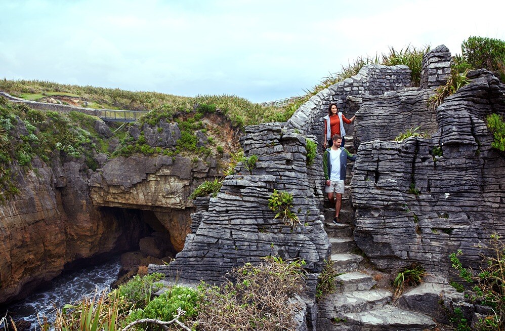
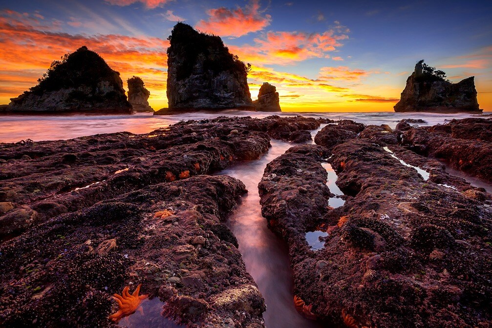
Pancake Rocks
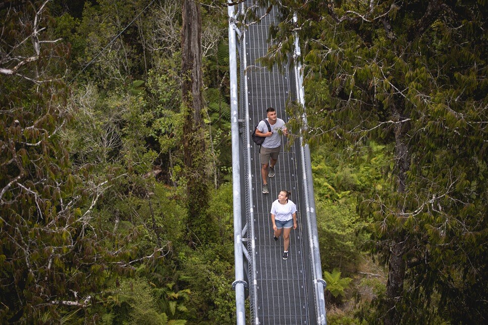
- West Coast Tree Top Walk and Tower Zipline
-
Franz Joseph Glacier
-
West Coast Wildlife Centre
-
Gillespies Beach
-
Crayfish Pot
-
LandEscape Wānaka
-
Arrow River Bridges Trail
-
Te Anau Glowworm Caves
-
Miles Better Pies
-
Mirror Lakes Walk
-
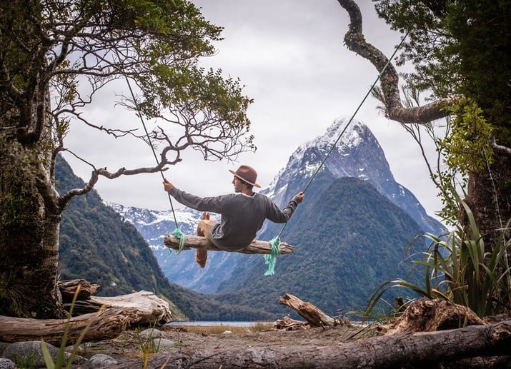
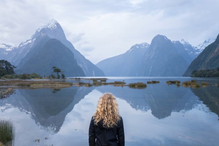
Milford Sound
-
Milford Track
-
Fergburger
-
Rees-Dart Track
-
Cromwell Farmers' & Craft Market
-
Victorian Precinct
-
Blue penguin colony
-
Corsair Bay
Day 1 - Christchurch to Punakaiki
To the Pancake Rocks
It was 30 million years ago when the unforgiving Tasman Sea began creating an ever-changing work of art at Punakaiki on the West Coast of New Zealand’s South Island.
Today, you can visit this incredible coastline with its many layers of hard limestone and soft sandstone rock — eroded away by persistent rain from above and crashing waves from below.
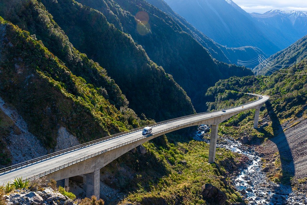
Begin by heading west on State Highway 73 (SH73) towards Arthur’s Pass.
Consider stopping at Cave Stream Scenic Reserve where there is literally a cave with a stream running through it. A well-known Christchurch favourite, Cave Stream offers a couple of hours of adventure if you have warm gear and a head torch.
Pull over at the Otira Viaduct Lookout for some of the best roadside views through the pass — and an opportunity to meet native kea.
Once you hit Kumara Junction, drive north through Greymouth hugging much of the spectacular coastline all the way to popular Punakaiki. Be sure to grab any groceries (and mozzie spray to keep the sandflies away) in Greymouth — where you’ll find the last supermarket before reaching Punakaiki.
Things to do at Punakaiki
- Visit the Pancake Rocks — it’s what everyone comes to see but instead of going at anytime of day, wait until high tide for some impressive blowhole spray
- Hike a portion of the Paparoa Track — one of the country’s great walks, it follows the river and a dramatic gorge through lush rainforest with nikau palms
- Explore the Punakaiki Cavern — the most accessible cave in this area is right by the main road with glowworms, stalactites and limestone rock
- Relax at the Punakaiki Rocks Hotel & Garden Bar —the green outdoor space with tranquil running water is ideal after a tiring hike
Check out our top ten free travel apps blog which discusses all the key apps you’ll need for a Milford Sound road trip.
Distance: 288km
Travel time: 3hr 53min
Stay: Pull into McMillan Road Punakaiki for beachside freedom camping or Punakaiki Beach Camp for an absolutely stunning central location beneath a magnificent limestone escarpment.
Directions: Take SH73 to Kumara Junction then turn north onto SH6 which becomes the Great Coast Road. Drive through Greymouth till you reach the coast and follow it all the way past Barrytown to Punakaiki.
Resources: Punakaiki
|
A single breeding ground
|
Day 2 - Punakaiki to Hokitika
Jade country
Follow your tracks back towards Greymouth while taking in a different perspective of one of the world’s most magnificent coastal roads.
Take your time by stopping at a few of the scenic roadside spots along the way — most notably, Jordale Rocks and Nine Mile Lookout. And if you time your drive within two hours either side of low tide, park up near Motukiekie Beach for a relaxing coastline stroll. Check the rock pools as sea creatures are often frollicking about in them.
Greymouth is a worthy large town for a lunch break. Consider calling into Buccleugh’s on High restaurant at The Recreation Hotel for a timeless open whitebait sandwich. Alternatively, stop by Sevenpenny for great food and craft beer, or visit Dp1 Cafe which offers gluten free, dairy, vegan and vegetarian options.
Continue south down SH6 to Hokitika — a quirky, arty beachside community and the home of pounamu (greenstone) in New Zealand.
Things to do in Hokitika
-
Wander across to Hokitika Beach — ideally around sunset to capture a stunning photo with the iconic Hokitika driftwood sign
-
Shop for jade — the town has plenty of greenstone, jewellery and arts and crafts stores to keep you entertained on a rainy afternoon
-
Detour to the West Coast Tree Top Walk and Tower Zipline — where you can enjoy a relaxing walk above the forest or an exhilarating ride back down to earth
-
Visit the Hokitika glowworm dell after dark — just north of town, it’s a magical place to walk through with or without kids
The West Coast has plenty of freedom camping spots so find out more about freedom camping for your New Zealand motorhome adventure.
Distance: 83km
Travel time: 1hr 6 min
Stay: For a comfortable central location, choose Hokitika Holiday Park near the beach.
Directions: Return south down SH6 through Greymouth and continue on to Hokitika.
Resources: Hokitika
|
The gold rush Hokitika was founded in 1864 and was the centre of the West Coast gold rush. The town became one of the country’s most populated — and by 1867 Hokitika port ranked first in NZ for total value of exports, primarily due to gold. |
Day 3 - Hokitika to Franz Josef
A UNESCO World Heritage Site awaits
Franz Josef town is located right next to the unique glacier of the same name. It’s your destination today and will take you about two hours to reach without stopping.
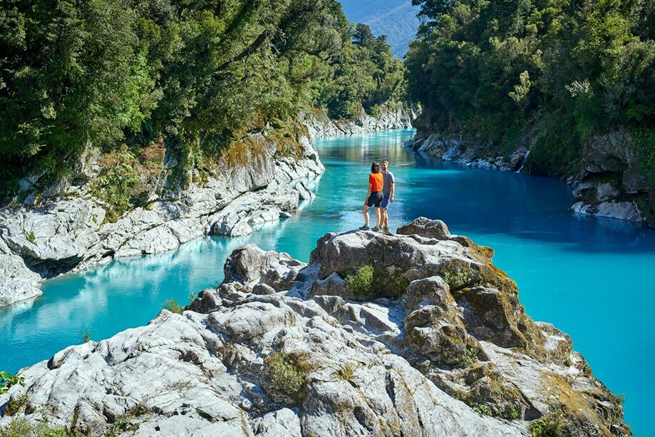
However, the road further south presents numerous opportunities to divert to some beautiful West Coast sites — the first of these being the majestic Hokitika Gorge. It’s a short drive inland to reach the trailhead. Just remember to apply your mosquito repellent because the mozzies are ferocious down by the river.
Keep an eye out for the unusual number plate fence in Ross — the small town where the West Coast Wilderness Trail ends. Take a rest from driving at Lake Ianthe Matahi Campsite. Visit the Ōkārito township near the sea for some incredible kayaking and walking trails.
After an eventful day of winding roads and rugged scenery, you’ll drive into Franz Josef village.
Things to do at Franz Josef
-
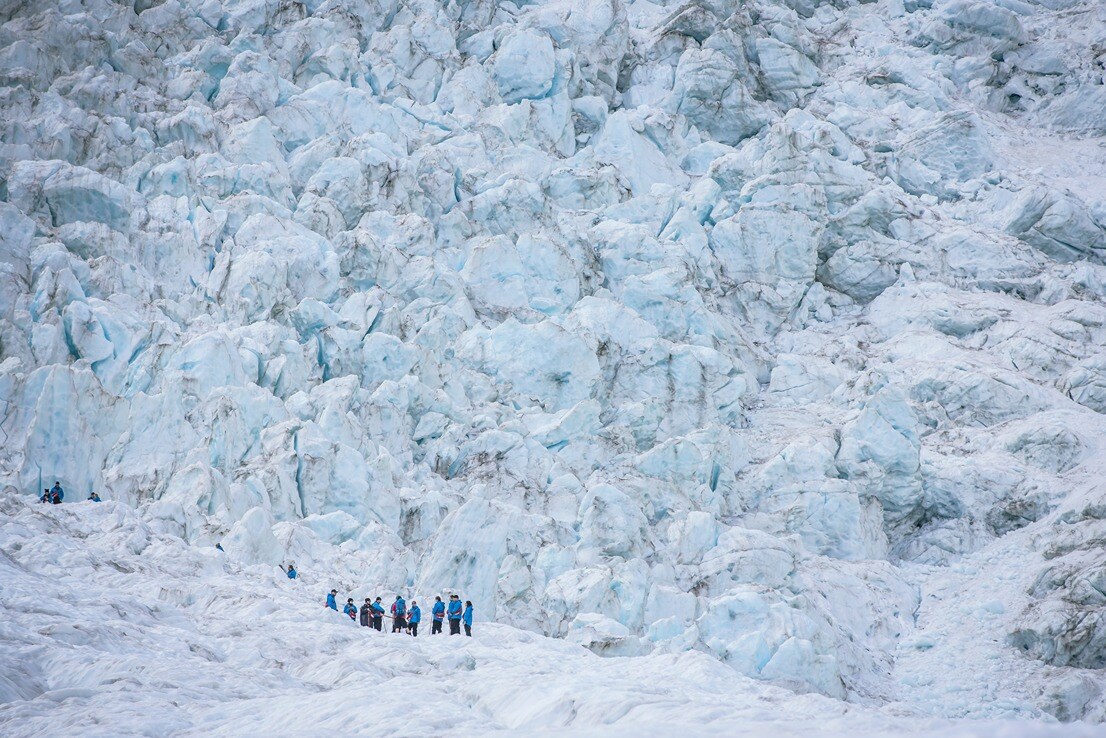
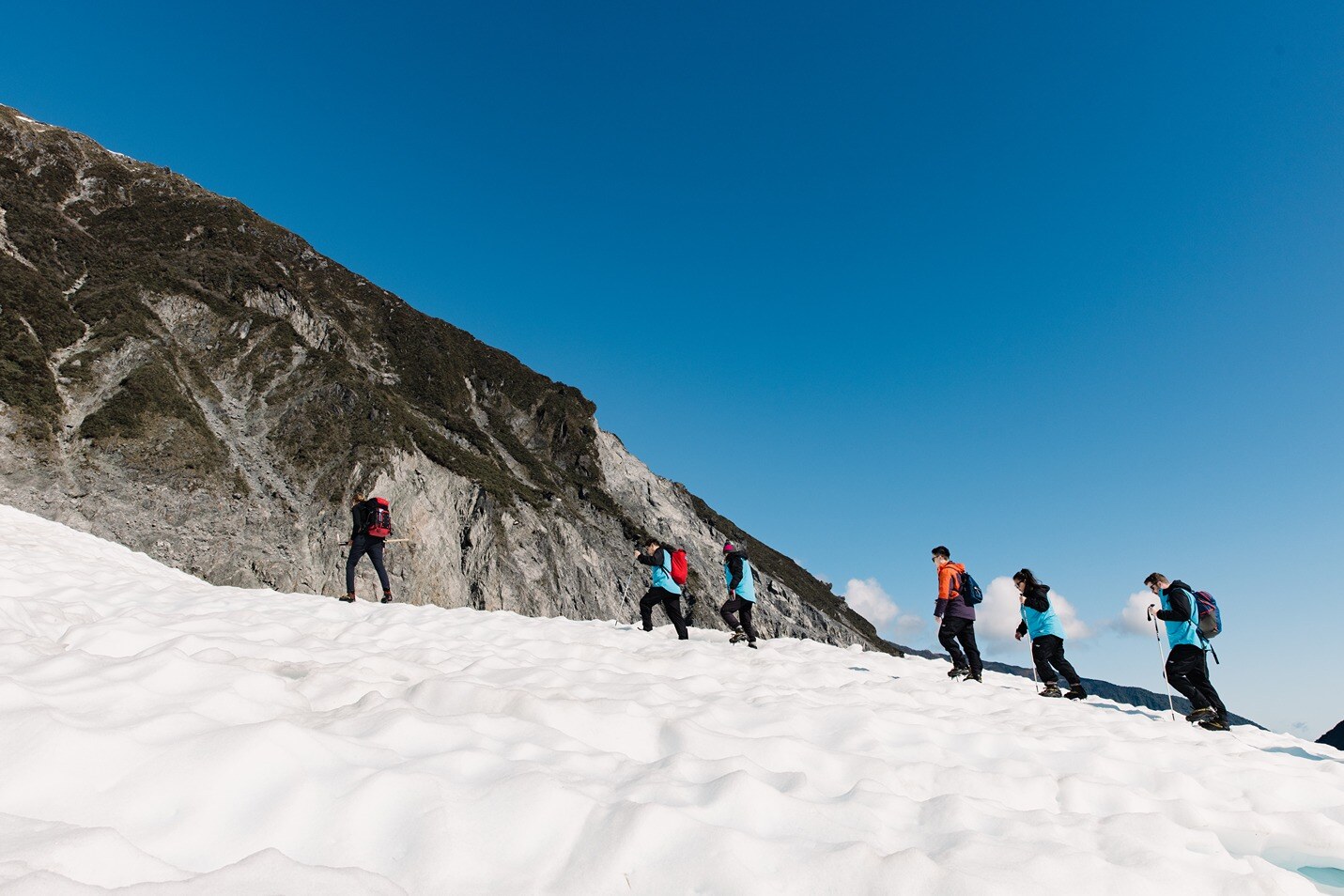
Hike to Franz Josef Glacier (Kā Roimata o Hine Hukatere) — to experience this phenomenon up close in a temperate environment
-
Book a helicopter tour — one which includes landing on the glacier and guided hiking with ice crampons over it
-
Observe young Rowi kiwi — the world’s rarest at the West Coast Wildlife Centre in a nocturnal walkthrough area
-
Check out a white heron (kotuku) nesting site — by joining White Heron Sanctuary Tours about 30 minutes south in Whataroa
Prepare thoroughly for your adventure by checking out our ten tips for planning a campervan trip.
Distance: 134km
Travel time: 1hr 47min
Stay: Rest at relaxing Orange Sheep Campervan Park which aims to offer all the essentials you’ll need at affordable prices.
Directions: Stick with SH6 as you carry on moving south near the coast until you reach the small town of Franz Josef.
Resources: Glacier country
|
The tears of Hine Hukatere The Māori name for Franz Josef Glacier is Kā Roimata o Hine Hukatere — meaning the tears of Hine Hukatere. |
Day 4 - Franz Josef to Fox Glacier
The untamed natural wilderness of glacier country
A short day of travel gives you the perfect chance to spend as much time hiking and viewing the two famous glaciers in this part of Westland — Franz Josef and Fox.
Sometimes considered the poor cousin of the better-known Franz Josef, the blue-coloured Fox Glacier is one of the most accessible glaciers across the globe. The road between the two glaciers is mostly hilly — but not without some panoramic views.
Driving into Fox, you’ll notice there aren’t many places to eat so it’s a smart idea to have your campervan fridge well stocked and your meals planned.
Take a look at our top tips for cooking on the road for ideas.
Things to do at Fox Glacier
-
Wander around Lake Matheson — and find the ideal viewpoint to snap a photo of the reflective lake in the foreground and Fox Glacier and Mount Cook in the background
-
Take in the sunset at Gillespies Beach — which features superb views of the Southern Alps, beach walks and a nearby seal colony
-
Hike the Fox Glacier South Side Walkway — which crosses ancient glacial moraine surfaces on a two hour return journey
- Fly over Fox Glacier in a helicopter or small plane — and see both Fox and Franz Josef glaciers (and Mount Cook) from up high
Distance: 24km
Travel time: 27min
Stay: The Fox Glacier Top Ten Holiday Park is central, fun for kids and has all the amenities you need.
Directions: Your one road to all things continues to be SH6. Keep following it south until you reach Fox Glacier.
Resources: Fox Glacier
|
From the alps to the rainforest |
Day 5 - Fox Glacier to Jackson Bay
To the end of the road
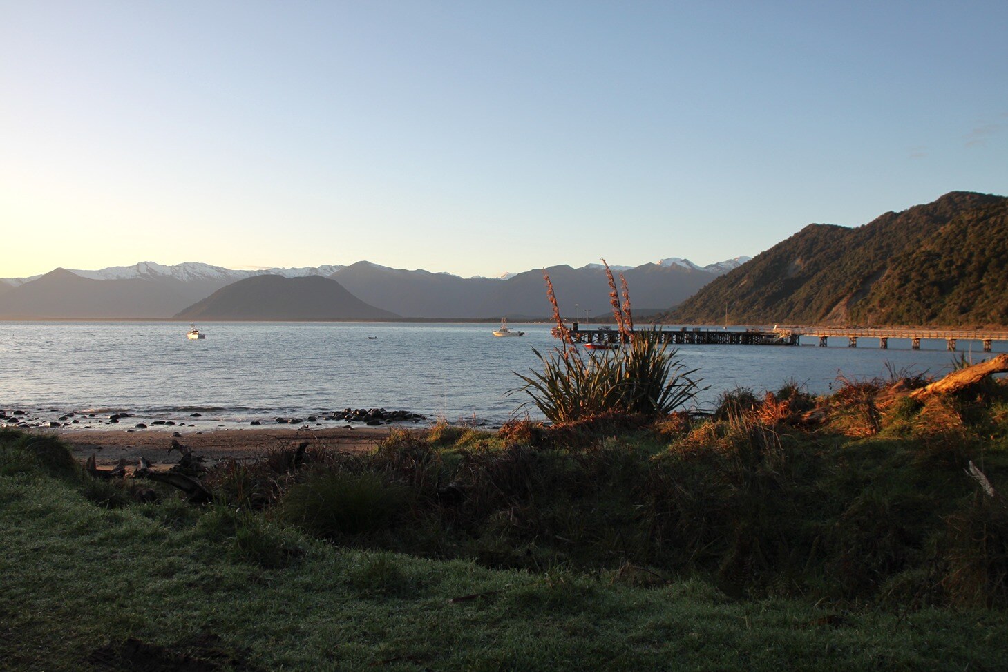
Occasionally there are places worth driving a little further to experience something special. Jackson Bay is one of those remote, rarely-visited areas that’s located about as far south as you can go on the West Coast.
Most travellers will pass straight through Haast — or take a quick break there for lunch. Very few turn onto the Haast-Jackson Bay Road and explore it.
Before reaching Haast, there are a few worthy places to pull over and stretch your legs. At Māori Beach you’ll find Bruce Bay Coffee Cart for a timely cuppa, Lake Paringa has a scenic campsite and South Westland Salmon Farm sells fresh salmon.
Haast township is surrounded by national parks — to the south, east and north. It’s a world heritage area with beautiful lakes, beaches and wetlands. Continue south to Jackson Bay to get the most out of this area.
To enjoy this remote location, pack well with the help of our packing checklist for a campervan road trip.
Things to do at Jackson Bay
-
Wander about the village — admiring the different viewing perspective of looking northeast towards the Southern Alps
-
Dine on crayfish at the Crayfish Pot — a true gem if you’re a seafood lover but just be aware it’s only open from September to Easter each year
-
Take time to enjoy one of Jackson Bay’s short walks — to encounter NZ fur seals walk the Wharekai-Te Kou trail over the hill
-
Pause for a while on the Haast-Jackson Bay Road and walk one of the interesting trails — like the Hapuka Estuary Walk featuring native pigeons (kererū) and other birdlife
Distance: 167km
Travel time: 2hr 09min
Stay: Jackson Bay doesn’t have any official camping ground or freedom camping spots so returning to Haast and checking in to the Haast River Motels and Holiday Park is your best bet.
Directions: Heading back onto SH6 and driving south will take you to Haast where switching to the Haast-Jackson Bay Road leads all the way to Jackson Bay.
Resources: Jackson Bay
|
A cemetery for pioneers Whalers and European settlers from an age long ago lie buried here at peaceful Arawhata Pioneer Cemetery not far from Jackson Bay. Their headstones tell stories of failed dreams and community hardship during the 1870s. |
Day 6 - Jackson Bay to Wānaka
Back over the divide
Leaving Haast, SH6 begins ascending over Haast Pass. A few walks and waterfalls are worth checking out, including Thunder Creek Falls and Fantail Falls.
Approaching the top of Haast Pass, there’s a car park with access to the Haast Pass Lookout Track. From this viewing spot, you’ll be able to see Mount Brewster on a fine day — reaching above 2500m.
Take a break in tiny Makarora and enjoy the brief but charming Makarora Bush Walk.
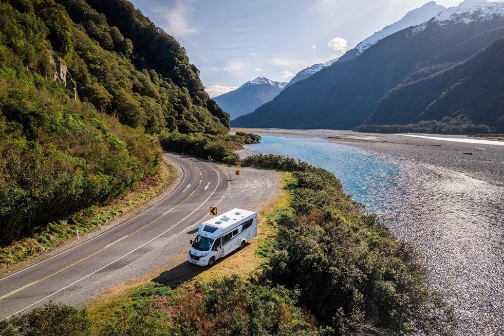
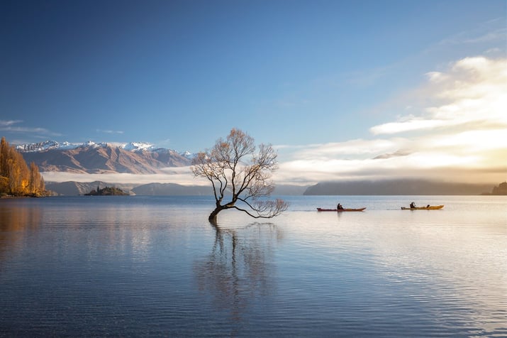
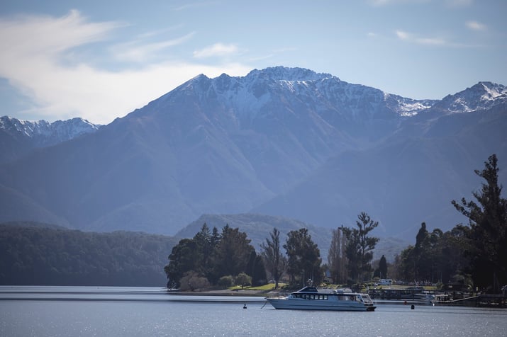
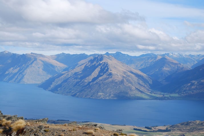
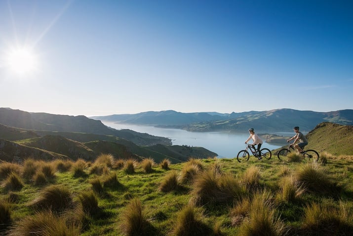
The road then skirts down the eastern edge of Lake Wānaka before cutting through to the western side of Lake Hāwea. The lake views along this section are spectacular — as are the hikes in the Wānaka area.
Find out more about New Zealand’s best hikes and walks.
Things to do in Wānaka
-
Spend some time at the Wānaka Lavender Farm enjoying the animals and plantlife
-
Walk up popular Roys Peak or nearby Mount Iron Track
-
Go mountain biking at Bike Glendhu — where you can not only enjoy the impressive trails but also the scenery over Glendhu Bay
-
Visit the eery Wānaka Tree that sits contentedly in the lake
-
Try fishing at Hook — where you can catch and eat your own salmon
Distance: 143km
Travel time: 1hr 58min
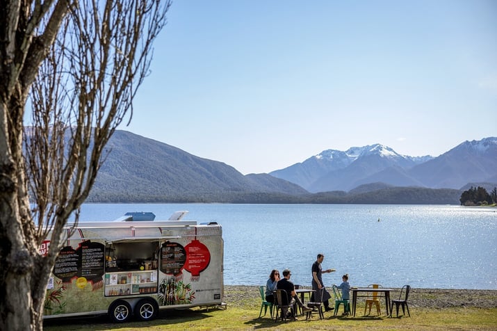
Stay: Halfway between Wānaka and Hawea is the next level camping experience of LandEscape Wānaka. Park up right by your own private wood-fired hot tub — and be amazed at what the locals have coined Spagazing.
Directions: If you stayed overnight in Haast, simply continue south on SH6 over the Haast Pass flying by Lake Wānaka and Lake Hawea until you reach SH84 and Wānaka.
Resources: Lake Wānaka
|
The secret past life of Ruby Island Idyllically situated in the middle of Lake Wānaka is Ruby Island. In the 1920s, it was surprisingly the site of an infamous cabaret with a dance floor and smuggled liquor — due to the regional prohibition policy in those days. |
Day 7 - Wānaka to Arrowtown
Pure gold does not rust
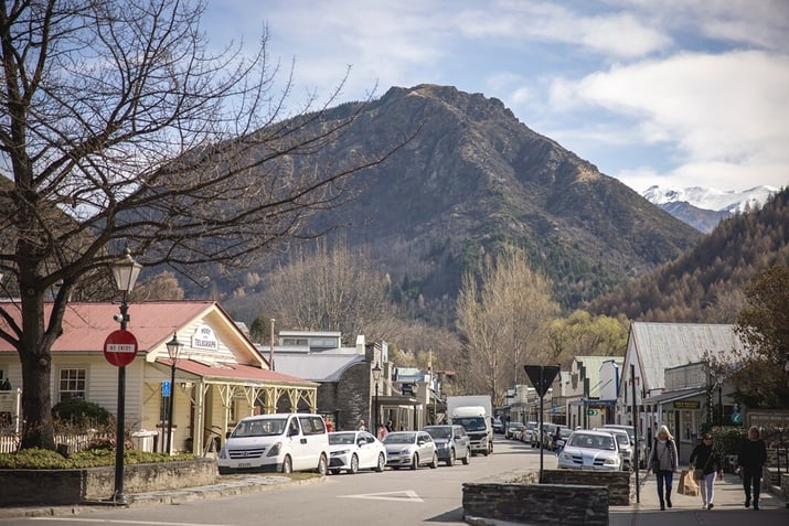
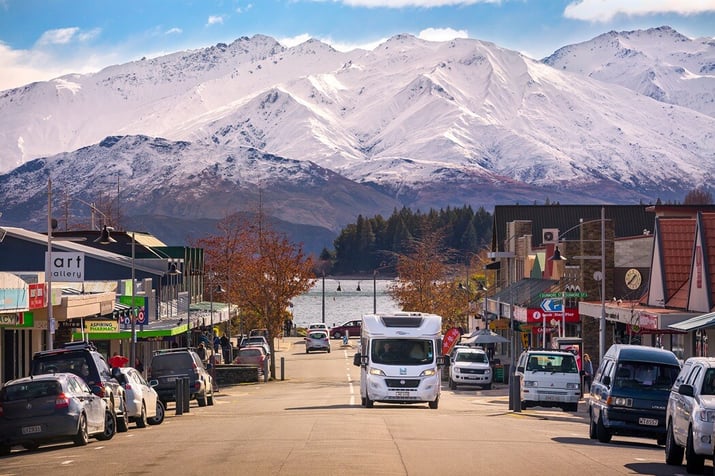
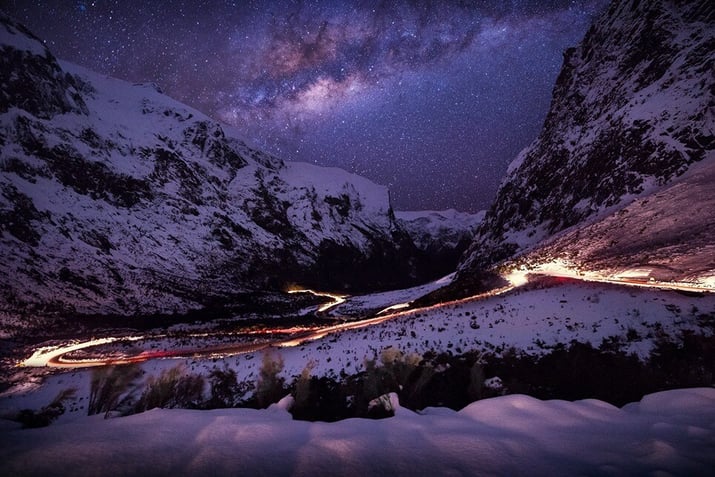
The Crown Range lies between scenic Wānaka and the historic old gold mining township of Arrowtown. It’s New Zealand’s highest main road, climbing up to 1121 metres above sea level where the weather can change rapidly and snow can come in without warning.
If the road is open, you’ll have to know how to use motorhome chains — and carry them with you. If the road is closed, there’s an alternative highway that travels via Cromwell at a lower altitude.
Drop by the historic Cardrona Hotel which was established in 1863. One of the few remains from this region’s gold rush era, it’s an iconic place to stop for a bite or a drink.
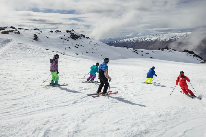
Also nestled within the Crown Range is Cardrona Alpine Resort. It’s a beloved destination for winter enthusiasts seeking the thrill of gliding down pristine slopes. And in summer, the resort transforms into an adventure playground with mountain bike trails.
Take a break at the Crown Range Road scenic lookout for superb panoramic views of the lakes below. Arrowtown is only a few kilometres away after you rejoin SH6.
A serene place in autumn, check out our blog about why it’s worthwhile visiting New Zealand during this season.
Things to do in Arrowtown
-
Play a round of golf at Millbrook or The Hills — a couple of New Zealand’s premier golf resorts
-
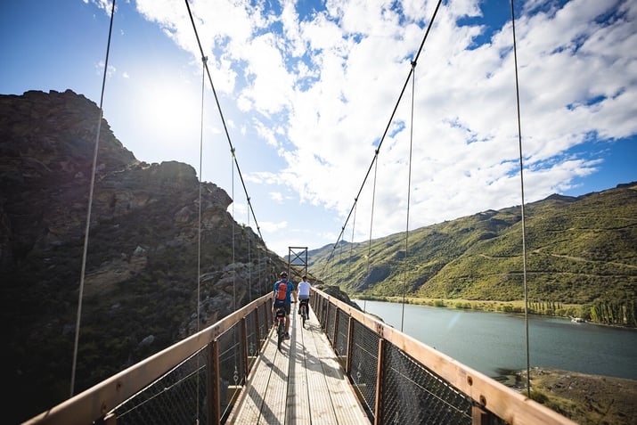
Bike the Arrow River Bridges Trail — which connects to a few of the other Queenstown trails in the area
-
Wander the boutique shopping precinct — where you can find old school sweets, woollen garments, antiques and wine
-
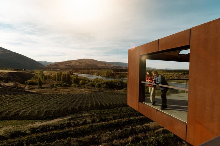
Visit a local winery — with Amisfield and Wet Jacket a couple of the best nearby
-
Pan for gold — you can hire a gold pan from the Lakes District Museum & Gallery
Distance: 55km
Travel time: 53min
Stay: Park up at Arrowtown Holiday Park where plenty of space and shady spots are available which is a relief during hot summers.
Directions: Take the Cardrona Valley Road south from Wānaka. It then becomes the Crown Range Road as you drive over the pass. You’ll turn right onto SH6 when this road ends — switching to McDonnell Road which takes you into Arrowtown.
Resources: Arrowtown
Day 8 - Arrowtown to Te Anau
The walking capital of NZ
Often a base for those hiking the world class Milford, Routeburn and Kepler tracks, Te Anau offers a relaxing lakeside feel — and is absolutely worth staying a few nights.
To get there you’ll take SH6 around Lake Wakatipu before turning west towards the South Island’s largest lake. Bypassing Queenstown for now, this scenic drive begins under The Remarkables and winds through the infamous Devil’s Staircase above Lake Wakatipu.
Be sure to pull over at a rest stop like the Devil’s Staircase Lookout Point or the Lake Wakatipu Lookout to soak up the incredible views.
If you have time, book a trip on the The Kingston Flyer — one of the few vintage New Zealand steam trains. If not, consider taking a break at the Garston Hunny Shop where you can get some quality manuka honey.
Things to do in Te Anau
-
Tour the Te Anau Glowworm Caves — the country’s best glowworm experience involves travelling through caves by boat amongst hundreds of these bioluminescent bugs
-
Walk a portion of the Kepler Track — heading clockwise for river views or anticlockwise for lake views and the opportunity to get up above the treeline
-
Take a day excursion to Mavora Lakes Conservation Park — a tranquil area with two large recreational lakes
-
Bike a section of the Lake2Lake Trail — between Lake Te Anau and Lake Manapouri
-
Try a couple of the reputable pies at Miles Better Pies
Miles Better Pies is closed during winter — which is unfortunate as a hearty pie can certainly warm up the body. Be sure you know how to stay warm on your winter motorhome adventure.
Distance: 178km
Travel time: 2hr 10min
Stay: Consider Te Anau Lakeview Holiday Park which is the town’s original campground located almost right on the waterfront.
Directions: Drive back to SH6 and follow the highway around the edge of Lake Wakatipu and further south to SH97. Switch to this road which ends at SH94 where you should turn right and take it all the way to Te Anau.
Resources: Te Anau Southland NZ
|
The cave of swirling water Te Anau commonly translates to the cave of swirling water — which acknowledges an ancient Māori legend that mystical glowing caves lie hidden somewhere along the lake. |
Day 9 - Te Anau to Milford Sound
Take the Homer Tunnel to Piopiotahi
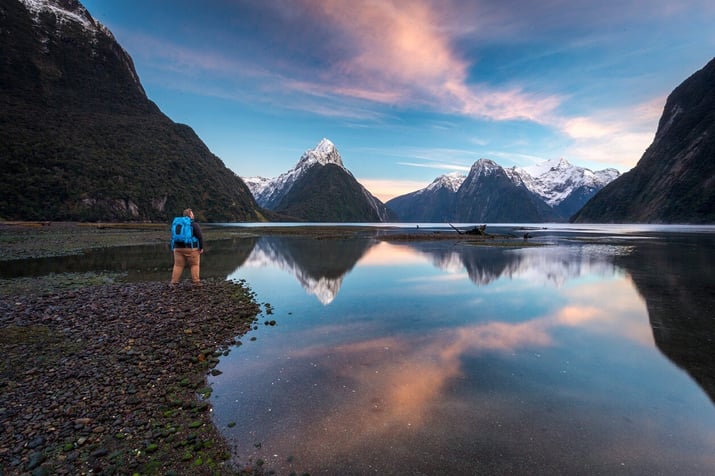
Of all your road tripping on this epic motorhome adventure, the phenomenal Milford-Te Anau Highway is going to be one you’ll remember for a long time. Plan for today’s journey to Milford Sound to take about half a day — so you have plenty of time to enjoy the drive and stop for walks.
Near Te Anau Downs is Lake Mistletoe Track. While further down the highway is the popular Mirror Lakes Walk with stunning reflections of the Earl Mountains.
One not to be missed is Lake Gunn Nature Walk — a short loop to the lake via an enchanting mossy trail that’s full of rich greens.
The Divide is also where the famous Routeburn Track begins. You could easily spend a few hours hiking some of the trail or even ascending Key Summit for a true taste of the terrain.
You’ll likely be greeted by a few cheeky kea if you pull over at Monkey Creek. Not long after this point, the Homer Tunnel appears to take you through the mountain to Milford Sound. It was a euphoric piece of engineering for its time and adds to the mystery of travelling to this extraordinary place.
Things to do at Milford Sound
-
Cruise the fiord — a popular attraction for viewing the environment up close with Real Journeys or Southern Discoveries
-
Kayak the sound — for a more intimate experience with some of the waterfalls and wildlife
-
Take a scenic flight — see Milford Sound from above with majestic views of the Southern Alps, hidden glaciers and alpine lakes
-
Walk a few of the shorter trails — such as the Milford Sound Lookout Track or the Milford Foreshore Walk
-
Try an underwater experience — dive amongst 150 fish species or simply observe some of them from an underwater observatory
-
Sample the Milford Track — by booking a morning boat ride from Milford Sound to Sandfly Point, walking a few hours of the track, then returning via boat to Milford
Get the scoop on motorhome entertainment so you’re well prepared for the wettest place in New Zealand.
Distance: 118km
Travel time: 1hr 43min
Stay: Camping options are limited so book early for the Rainforest Campervan Park at Milford Sound Lodge.
Directions: The Milford-Te Anau Highway (SH94) will take you door-to-door, making today’s road journey all about enjoying the imposing scenery.
Resources: Milford Sound Fiordland
|
A sound or fiord? Milford Sound isn’t actually a sound — it’s a fiord. A sound is created as the sea floods a river valley. A fiord emerges from the sculpting power of glaciers in a majestic valley. |
Day 10 - Milford Sound to Queenstown
The adventure capital of the world
The steep climb out of Milford Sound to the Homer Tunnel is just the start of another spectacular driving day where you’ll experience the same road but in reverse.
Don’t miss the short Chasm Walk and Hundred Falls where you can stop and take some amazing photos and video — particularly if there’s been a lot of rain.
Keep a look out for kea while waiting for a green light to travel through the Homer Tunnel. And be careful not to leave any loose items around because this cheeky native alpine parrot will take them.
Follow your trail back through Te Anau and past Lake Wakatipu until you reach SH6A where a left turn will lead you to Queenstown.
Check out the best campsites in Queenstown before you reach the lakefront.
Things to do in Queenstown
-
Bite into a famous Fergburger after a long day’s travel
-
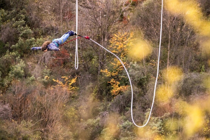
Bungy jump at the home of the world’s first commercial one — the Kawarau Bridge Bungy
-
Cruise Lake Wakatipu on the iconic TSS Earnslaw
-
Visit The Winery in central Queenstown — where you can taste up to 80 of New Zealand’s premium wines
-
Ascend Bob’s Peak via the Skyline Gondola — then return back downhill on the Skyline Luge
- Embark on a leisurely stroll along the shoreline of Lake Wakatipu
Distance: 288km
Travel time: 3hr 52min
Stay: Check into Driftaway Queenstown which is one of the town’s newest campsites right on the waterfront.
Directions: Return back down SH94 through Te Anau and then briefly SH97 to SH6 back to Queenstown Airport. Transfer to SH6A to enter the town. For motorhome parking spots, check the library car park by Queenstown Recreational Reserve.
Resources: QueenstownNZ
|
How deep is a lake Lake Wakatipu is not only the longest lake in the country, it’s also one of the deepest. Queenstown’s lake is about 310m above sea level — while the deepest part is actually below sea level. |
Day 11 - Queenstown to Glenorchy
Feel like you're flying
Prepare yourself for arguably the most beautiful lakeside drive in New Zealand. Venturing southwest out of Queenstown there’s only one road — and it will take you to Glenorchy.
Today’s relatively short day of driving opens up opportunities to take breaks on numerous walking trails. Consider visiting a high country lake on the Lake Dispute Track or hiking a fun one for kids — the Mount Crichton Loop Track.
Bob’s Cove Track offers a short stroll through native bush to a lake cove while it’s also worth pulling over at Bennetts Bluff to view the epic scenery.
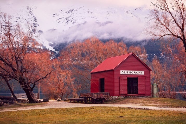
You’ll soon arrive in Glenorchy — a town on the western edge of Otago. The weather can get wintery down here so learn how to fit snow chains on your motorhome.
Things to do in Glenorchy
-
Wander across the Glenorchy Walkway — over wetlands with birds galore
-
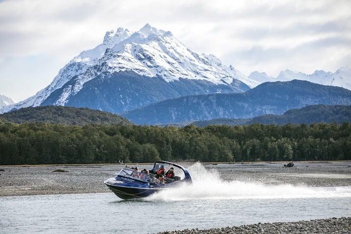
Explore the Dart River — by jet boat, a funyak or on two feet on the Rees-Dart Track
-
Experience a family farm with your family — the Glenorchy Animal Experience has llamas, Clydesdale horses, sheep, Kunekune pigs and even beehives
-
Hike a section of the Routeburn Track — if you start early, it’s possible to walk in to Routeburn Falls and return to your motorhome the same day
Distance: 288km
Travel time: 3hr 52min
Stay: It’s hard to go past iconic Mrs Woolly’s Campground near the entrance to the town. It’s closed in the off-season but you may be able to park up at the Glenorchy Hotel if you check with the publican.
Directions: Take your time enjoying the Glenorchy-Queenstown Road and its scenic beauty.
Resources: Glenorchy community
|
The lake that breathes Scientists have been mystified for years by Lake Wakatipu’s water level rising and falling around 20cm every 27 minutes. This suggests tidal activity but the lake isn’t big enough to be considered tidal. |
Day 12 - Glenorchy to Cromwell
Follow the Kawarau Gorge
Today’s destination is right next to a human-made lake — which might catch you off guard given the natural beauty of most lakes throughout New Zealand.
Take the superlative lakeshore drive back to Queenstown. This can be an ideal lunch stop or you could visit one of the many popular wineries near the Kawarau River.
Gibbston Valley and Peregrine Wines are well worth a visit. Further through the gorge, Roaring Meg Power Station and ANZAC memorial is an interesting piece of history.
As you approach Cromwell, an exhilarating thrill awaits at Highlands Motorsport Park — if you’re into fast vehicles.
Things to do in Cromwell
-
Embark on a thrilling bike ride along the Lake Dunstan Trail — with its tight corners, high climbs and even lakeside burgers
-
Try some of the local produce at Cromwell Farmers’ & Craft Market
-
Taste Central Otago wines around Lake Dunstan — at a few of the unique boutique wineries
-
Immerse yourself in the rich history of Cromwell — by exploring the well-preserved Cromwell Heritage Precinct
- Relax among the picturesque settings of Lake Dunstan’s barbecue areas — with jetties for admiring the view or taking a refreshing plunge
Distance: 105km
Travel time: 1hr 35min
Stay: For something a little different out of town, try Bannockburn Domain Camping Ground.
Directions: Return to Queenstown along the lakeside and then follow SH6 through the Kawarau Gorge to Cromwell.
Resources: Cromwell Central Otago
|
The Dunstan gold rush It wasn’t only Arrowtown that attracted gold miners to Central Otago — Cromwell also had its fair share. European and Chinese prospectors came to this region to try their luck in the mid 1800s. |
Day 13 - Cromwell to Oamaru
The global capital of Steampunk
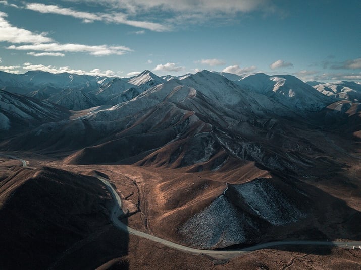
You’re now on your return journey to Christchurch and will travel over the barren yet beautiful Lindis Pass to the gliding mecca of Omarama. Turning east towards Oamaru, you’ll take a route that’s rarely travelled.
Be sure to pull over at the Lindis Pass Viewpoint to breathe in the fresh air and enjoy the unique scenery. Once at Omarama, The Wrinkly Rams is an interesting cafe to call into and refuel.
The road towards the coast passes a few lakes, notably Lake Benmore and Lake Aviemore. When you reach SH1, turn back south to Oamaru.
Things to do in Oamaru
-
Dine at Riverstone Kitchen — an award-winning restaurant just north of the town that uses seasonal local produce
-
Wander the Victorian Precinct — the home of the revitalisation of Steampunk in New Zealand
-
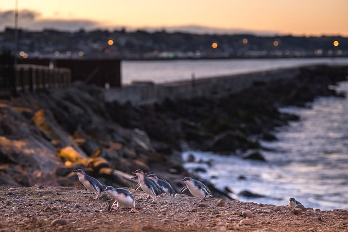
See the blue penguin colony — the best time to view it is just after sunset
-
Visit the Oamaru Public Gardens — some of the oldest in the country
-
Sample Whitestone Cheese — and take a factory tour at 10am weekdays
Find a recipe to go with your delicious cheese entre in our best recipes for the road booklet.
Distance: 288km
Travel time: 2hr 50min
Stay: Chill out by the seaside at Oamaru Harbour Tourist Park right in the heart of the town.
Directions: Travel north from Cromwell on SH8 over the Lindis Pass before changing to SH83 at Omarama. Follow this route to its end at SH1 and turn south where Oamaru is just down the road.
Resources: Tourism Waitaki Oamaru
|
From quiet community to world famous town The story of Oamaru’s transition from a shy rural town to a global icon that embraced a slightly weird subculture is certainly intriguing. |
Day 14 - Oamaru to Christchurch
The journey home
The rolling hills north of Oamaru will be your road back to base as your final day begins.
It won’t be long before you pass through Timaru where Caroline Bay is a lively focal point. If you plan to extend your trip and stay here overnight, the Te Ana Māori Rock Art Tours are worth investigating.
Further north, Temuka is well known for its pottery so can make for a timely rest break if you’re interested in this type of artisan product.
Salmon World in Rakaia can be a great place to entertain kids — or to purchase some salmon for lunch.
Things to do in Oamaru
-
Spend some time at the free Air Force Museum of New Zealand — and find out about the origins of this country’s air power
-
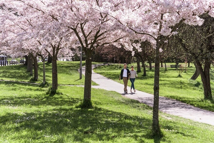
Relish the invigorating sea breeze at one of the cities beaches — try New Brighton, Sumner Beach or Corsair Bay
-
Navigate Summit Road — where you’ll be rewarded with awe-inspiring views of the city and the vast Canterbury Plains
-
Take a leisurely walk through Hagley Park — a relaxing way to spend your afternoon before departing on a flight
-
Explore the International Antarctic Centre — for an immersive experience into the world of Antarctica
See our Christchurch motorhome holiday guide for plenty more tips on what to do in New Zealand’s second largest city.
Distance: 247km
Travel time: 3hr 07min
Stay: Opt for the South Brighton Holiday Park or one of the freedom camping locations on Marine Parade to enjoy a beachside stay.
Directions: Head north up SH1 to Christchurch following signs to Christchurch International Airport to drop off your campervan or motorhome.
Resources: Tourism Waitaki Oamaru
Now that you know what a Christchurch to Milford Sound West Coast adventure can offer, it may be time to take the next step.

-
About this itinerary
A discovery of untamed nature
Untouched — earthy — breathtaking. A journey down the West Coast is one full of unexpected sights and fascinating encounters. It’s an adventure into another time where you’ll feel like it’s just you and the raw beauty of Mother Earth.
Get super excited about this two week Christchurch to Milford Sound road trip that will take you through the rugged natural wilderness of the West Coast of New Zealand’s South Island.
From limestone caverns to seaview glaciers, from isolated fishing villages to historic settlements, from deep lakes to majestic fiords — we highlight all the richness of the Coast.
Experience panning for gold, hiking on ice, kayaking below towering peaks and caving for glowworms.
Make a beeline for Punakaiki on the West Coast then travel south hugging the shoreline before crossing the divide twice to reach Milford Sound — returning via Cromwell in the heart of wine country and Oamaru where Steampunk lives on.
Highlights
-
Pancake Rocks
- West Coast Tree Top Walk and Tower Zipline
-
Franz Joseph Glacier
-
West Coast Wildlife Centre
-
Gillespies Beach
-
Crayfish Pot
-
LandEscape Wānaka
-
Arrow River Bridges Trail
-
Te Anau Glowworm Caves
-
Miles Better Pies
-
Mirror Lakes Walk
-
Milford Sound
-
Milford Track
-
Fergburger
-
Rees-Dart Track
-
Cromwell Farmers' & Craft Market
-
Victorian Precinct
-
Blue penguin colony
-
Corsair Bay
-
-
Day 1 - Christchurch to Punakaiki
To the Pancake Rocks
It was 30 million years ago when the unforgiving Tasman Sea began creating an ever-changing work of art at Punakaiki on the West Coast of New Zealand’s South Island.Today, you can visit this incredible coastline with its many layers of hard limestone and soft sandstone rock — eroded away by persistent rain from above and crashing waves from below.
Begin by heading west on State Highway 73 (SH73) towards Arthur’s Pass.
Consider stopping at Cave Stream Scenic Reserve where there is literally a cave with a stream running through it. A well-known Christchurch favourite, Cave Stream offers a couple of hours of adventure if you have warm gear and a head torch.
Pull over at the Otira Viaduct Lookout for some of the best roadside views through the pass — and an opportunity to meet native kea.
Once you hit Kumara Junction, drive north through Greymouth hugging much of the spectacular coastline all the way to popular Punakaiki. Be sure to grab any groceries (and mozzie spray to keep the sandflies away) in Greymouth — where you’ll find the last supermarket before reaching Punakaiki.
Things to do at Punakaiki
- Visit the Pancake Rocks — it’s what everyone comes to see but instead of going at anytime of day, wait until high tide for some impressive blowhole spray
- Hike a portion of the Paparoa Track — one of the country’s great walks, it follows the river and a dramatic gorge through lush rainforest with nikau palms
- Explore the Punakaiki Cavern — the most accessible cave in this area is right by the main road with glowworms, stalactites and limestone rock
- Relax at the Punakaiki Rocks Hotel & Garden Bar —the green outdoor space with tranquil running water is ideal after a tiring hike
Check out our top ten free travel apps blog which discusses all the key apps you’ll need for a Milford Sound road trip.
Distance: 288km
Travel time: 3hr 53min
Stay: Pull into McMillan Road Punakaiki for beachside freedom camping or Punakaiki Beach Camp for an absolutely stunning central location beneath a magnificent limestone escarpment.
Directions: Take SH73 to Kumara Junction then turn north onto SH6 which becomes the Great Coast Road. Drive through Greymouth till you reach the coast and follow it all the way past Barrytown to Punakaiki.
Resources: PunakaikiA single breeding ground
Dark Westland petrel birds can be seen throughout the coastal South Island but they only breed in one place — and that’s here in Punakaiki - Visit the Pancake Rocks — it’s what everyone comes to see but instead of going at anytime of day, wait until high tide for some impressive blowhole spray
-
Day 2 - Punakaiki to Hokitika
Jade country
Follow your tracks back towards Greymouth while taking in a different perspective of one of the world’s most magnificent coastal roads.
Take your time by stopping at a few of the scenic roadside spots along the way — most notably, Jordale Rocks and Nine Mile Lookout. And if you time your drive within two hours either side of low tide, park up near Motukiekie Beach for a relaxing coastline stroll. Check the rock pools as sea creatures are often frollicking about in them.
Greymouth is a worthy large town for a lunch break. Consider calling into Buccleugh’s on High restaurant at The Recreation Hotel for a timeless open whitebait sandwich. Alternatively, stop by Sevenpenny for great food and craft beer, or visit Dp1 Cafe which offers gluten free, dairy, vegan and vegetarian options.
Continue south down SH6 to Hokitika — a quirky, arty beachside community and the home of pounamu (greenstone) in New Zealand.
Things to do in Hokitika-
Wander across to Hokitika Beach — ideally around sunset to capture a stunning photo with the iconic Hokitika driftwood sign
-
Shop for jade — the town has plenty of greenstone, jewellery and arts and crafts stores to keep you entertained on a rainy afternoon
-
Detour to the West Coast Tree Top Walk and Tower Zipline — where you can enjoy a relaxing walk above the forest or an exhilarating ride back down to earth
-
Visit the Hokitika glowworm dell after dark — just north of town, it’s a magical place to walk through with or without kids
The West Coast has plenty of freedom camping spots so find out more about freedom camping for your New Zealand motorhome adventure.
Distance: 83kmTravel time: 1hr 6 min
Stay: For a comfortable central location, choose Hokitika Holiday Park near the beach.
Directions: Return south down SH6 through Greymouth and continue on to Hokitika.
Resources: HokitikaThe gold rush
Hokitika was founded in 1864 and was the centre of the West Coast gold rush. The town became one of the country’s most populated — and by 1867 Hokitika port ranked first in NZ for total value of exports, primarily due to gold.
-
-
Day 3 - Hokitika to Franz Josef
A UNESCO World Heritage Site awaits
Franz Josef town is located right next to the unique glacier of the same name. It’s your destination today and will take you about two hours to reach without stopping.
However, the road further south presents numerous opportunities to divert to some beautiful West Coast sites — the first of these being the majestic Hokitika Gorge. It’s a short drive inland to reach the trailhead. Just remember to apply your mosquito repellent because the mozzies are ferocious down by the river.
Keep an eye out for the unusual number plate fence in Ross — the small town where the West Coast Wilderness Trail ends. Take a rest from driving at Lake Ianthe Matahi Campsite. Visit the Ōkārito township near the sea for some incredible kayaking and walking trails.
After an eventful day of winding roads and rugged scenery, you’ll drive into Franz Josef village.
Things to do at Franz Josef-
Hike to Franz Josef Glacier (Kā Roimata o Hine Hukatere) — to experience this phenomenon up close in a temperate environment
-
Book a helicopter tour — one which includes landing on the glacier and guided hiking with ice crampons over it
-
Observe young Rowi kiwi — the world’s rarest at the West Coast Wildlife Centre in a nocturnal walkthrough area
-
Check out a white heron (kotuku) nesting site — by joining White Heron Sanctuary Tours about 30 minutes south in Whataroa
Prepare thoroughly for your adventure by checking out our ten tips for planning a campervan trip.
Distance: 134kmTravel time: 1hr 47min
Stay: Rest at relaxing Orange Sheep Campervan Park which aims to offer all the essentials you’ll need at affordable prices.
Directions: Stick with SH6 as you carry on moving south near the coast until you reach the small town of Franz Josef.
Resources: Glacier country
The tears of Hine Hukatere
The Māori name for Franz Josef Glacier is Kā Roimata o Hine Hukatere — meaning the tears of Hine Hukatere.
Hine Hukatere adored climbing in the mountains. She convinced her lover, Wawe, to join her but he didn’t have as much experience climbing mountains as Hine Hukatere. One day, an avalanche swept him to his death and Hine Hukatere was left heartbroken.
It is said that her tears flowed down the mountain — and then froze to form this mighty glacier. -
-
Day 4 - Franz Josef to Fox Glacier
The untamed natural wilderness of glacier country
A short day of travel gives you the perfect chance to spend as much time hiking and viewing the two famous glaciers in this part of Westland — Franz Josef and Fox.
Sometimes considered the poor cousin of the better-known Franz Josef, the blue-coloured Fox Glacier is one of the most accessible glaciers across the globe. The road between the two glaciers is mostly hilly — but not without some panoramic views.
Driving into Fox, you’ll notice there aren’t many places to eat so it’s a smart idea to have your campervan fridge well stocked and your meals planned.
Take a look at our top tips for cooking on the road for ideas.
Things to do at Fox Glacier-
Wander around Lake Matheson — and find the ideal viewpoint to snap a photo of the reflective lake in the foreground and Fox Glacier and Mount Cook in the background
-
Take in the sunset at Gillespies Beach — which features superb views of the Southern Alps, beach walks and a nearby seal colony
-
Hike the Fox Glacier South Side Walkway — which crosses ancient glacial moraine surfaces on a two hour return journey
- Fly over Fox Glacier in a helicopter or small plane — and see both Fox and Franz Josef glaciers (and Mount Cook) from up high
Distance: 24km
Travel time: 27min
Stay: The Fox Glacier Top Ten Holiday Park is central, fun for kids and has all the amenities you need.
Directions: Your one road to all things continues to be SH6. Keep following it south until you reach Fox Glacier.
Resources: Fox Glacier
From the alps to the rainforest
Fox Glacier begins in the Southern Alps and travels 13km in length while falling 2600m in altitude — ending near the coast amongst temperate rainforest some 300m above sea level. -
-
Day 5 - Fox Glacier to Jackson Bay
To the end of the road
Occasionally there are places worth driving a little further to experience something special. Jackson Bay is one of those remote, rarely-visited areas that’s located about as far south as you can go on the West Coast.Most travellers will pass straight through Haast — or take a quick break there for lunch. Very few turn onto the Haast-Jackson Bay Road and explore it.
Before reaching Haast, there are a few worthy places to pull over and stretch your legs. At Māori Beach you’ll find Bruce Bay Coffee Cart for a timely cuppa, Lake Paringa has a scenic campsite and South Westland Salmon Farm sells fresh salmon.
Haast township is surrounded by national parks — to the south, east and north. It’s a world heritage area with beautiful lakes, beaches and wetlands. Continue south to Jackson Bay to get the most out of this area.
To enjoy this remote location, pack well with the help of our packing checklist for a campervan road trip.
Things to do at Jackson Bay
-
Wander about the village — admiring the different viewing perspective of looking northeast towards the Southern Alps
-
Dine on crayfish at the Crayfish Pot — a true gem if you’re a seafood lover but just be aware it’s only open from September to Easter each year
-
Take time to enjoy one of Jackson Bay’s short walks — to encounter NZ fur seals walk the Wharekai-Te Kou trail over the hill
-
Pause for a while on the Haast-Jackson Bay Road and walk one of the interesting trails — like the Hapuka Estuary Walk featuring native pigeons (kererū) and other birdlife
Distance: 167km
Travel time: 2hr 09min
Stay: Jackson Bay doesn’t have any official camping ground or freedom camping spots so returning to Haast and checking in to the Haast River Motels and Holiday Park is your best bet.
Directions: Heading back onto SH6 and driving south will take you to Haast where switching to the Haast-Jackson Bay Road leads all the way to Jackson Bay.
Resources: Jackson Bay
A cemetery for pioneers
Whalers and European settlers from an age long ago lie buried here at peaceful Arawhata Pioneer Cemetery not far from Jackson Bay. Their headstones tell stories of failed dreams and community hardship during the 1870s.
-
-
Day 6 - Jackson Bay to Wānaka
Back over the divide
Leaving Haast, SH6 begins ascending over Haast Pass. A few walks and waterfalls are worth checking out, including Thunder Creek Falls and Fantail Falls.Approaching the top of Haast Pass, there’s a car park with access to the Haast Pass Lookout Track. From this viewing spot, you’ll be able to see Mount Brewster on a fine day — reaching above 2500m.
Take a break in tiny Makarora and enjoy the brief but charming Makarora Bush Walk.
The road then skirts down the eastern edge of Lake Wānaka before cutting through to the western side of Lake Hāwea. The lake views along this section are spectacular — as are the hikes in the Wānaka area.
Find out more about New Zealand’s best hikes and walks.
Things to do in Wānaka
-
Spend some time at the Wānaka Lavender Farm enjoying the animals and plantlife
-
Walk up popular Roys Peak or nearby Mount Iron Track
-
Go mountain biking at Bike Glendhu — where you can not only enjoy the impressive trails but also the scenery over Glendhu Bay
-
Visit the eery Wānaka Tree that sits contentedly in the lake
-
Try fishing at Hook — where you can catch and eat your own salmon
Distance: 143km
Travel time: 1hr 58min
Stay: Halfway between Wānaka and Hawea is the next level camping experience of LandEscape Wānaka. Park up right by your own private wood-fired hot tub — and be amazed at what the locals have coined Spagazing.
Directions: If you stayed overnight in Haast, simply continue south on SH6 over the Haast Pass flying by Lake Wānaka and Lake Hawea until you reach SH84 and Wānaka.
Resources: Lake Wānaka
The secret past life of Ruby Island
Idyllically situated in the middle of Lake Wānaka is Ruby Island. In the 1920s, it was surprisingly the site of an infamous cabaret with a dance floor and smuggled liquor — due to the regional prohibition policy in those days.
-
-
Day 7 - Wānaka to Arrowtown
Pure gold does not rust
The Crown Range lies between scenic Wānaka and the historic old gold mining township of Arrowtown. It’s New Zealand’s highest main road, climbing up to 1121 metres above sea level where the weather can change rapidly and snow can come in without warning.
If the road is open, you’ll have to know how to use motorhome chains — and carry them with you. If the road is closed, there’s an alternative highway that travels via Cromwell at a lower altitude.
Drop by the historic Cardrona Hotel which was established in 1863. One of the few remains from this region’s gold rush era, it’s an iconic place to stop for a bite or a drink.
Also nestled within the Crown Range is Cardrona Alpine Resort. It’s a beloved destination for winter enthusiasts seeking the thrill of gliding down pristine slopes. And in summer, the resort transforms into an adventure playground with mountain bike trails.
Take a break at the Crown Range Road scenic lookout for superb panoramic views of the lakes below. Arrowtown is only a few kilometres away after you rejoin SH6.
A serene place in autumn, check out our blog about why it’s worthwhile visiting New Zealand during this season.
Things to do in Arrowtown-
Play a round of golf at Millbrook or The Hills — a couple of New Zealand’s premier golf resorts
-
Bike the Arrow River Bridges Trail — which connects to a few of the other Queenstown trails in the area
-
Wander the boutique shopping precinct — where you can find old school sweets, woollen garments, antiques and wine
-
Visit a local winery — with Amisfield and Wet Jacket a couple of the best nearby
-
Pan for gold — you can hire a gold pan from the Lakes District Museum & Gallery
Distance: 55km
Travel time: 53min
Stay: Park up at Arrowtown Holiday Park where plenty of space and shady spots are available which is a relief during hot summers.
Directions: Take the Cardrona Valley Road south from Wānaka. It then becomes the Crown Range Road as you drive over the pass. You’ll turn right onto SH6 when this road ends — switching to McDonnell Road which takes you into Arrowtown.
Resources: Arrowtown
-
-
Day 8 - Arrowtown to Te Anau
The walking capital of NZ
Often a base for those hiking the world class Milford, Routeburn and Kepler tracks, Te Anau offers a relaxing lakeside feel — and is absolutely worth staying a few nights.To get there you’ll take SH6 around Lake Wakatipu before turning west towards the South Island’s largest lake. Bypassing Queenstown for now, this scenic drive begins under The Remarkables and winds through the infamous Devil’s Staircase above Lake Wakatipu.
Be sure to pull over at a rest stop like the Devil’s Staircase Lookout Point or the Lake Wakatipu Lookout to soak up the incredible views.
If you have time, book a trip on the The Kingston Flyer — one of the few vintage New Zealand steam trains. If not, consider taking a break at the Garston Hunny Shop where you can get some quality manuka honey.
Things to do in Te Anau
-
Tour the Te Anau Glowworm Caves — the country’s best glowworm experience involves travelling through caves by boat amongst hundreds of these bioluminescent bugs
-
Walk a portion of the Kepler Track — heading clockwise for river views or anticlockwise for lake views and the opportunity to get up above the treeline
-
Take a day excursion to Mavora Lakes Conservation Park — a tranquil area with two large recreational lakes
-
Bike a section of the Lake2Lake Trail — between Lake Te Anau and Lake Manapouri
-
Try a couple of the reputable pies at Miles Better Pies
Miles Better Pies is closed during winter — which is unfortunate as a hearty pie can certainly warm up the body. Be sure you know how to stay warm on your winter motorhome adventure.
Distance: 178km
Travel time: 2hr 10min
Stay: Consider Te Anau Lakeview Holiday Park which is the town’s original campground located almost right on the waterfront.
Directions: Drive back to SH6 and follow the highway around the edge of Lake Wakatipu and further south to SH97. Switch to this road which ends at SH94 where you should turn right and take it all the way to Te Anau.
Resources: Te Anau Southland NZ
The cave of swirling water
Te Anau commonly translates to the cave of swirling water — which acknowledges an ancient Māori legend that mystical glowing caves lie hidden somewhere along the lake.
In 1948, intrepid explorers rediscovered these captivating underground glowworm grottos. They’re now one of the major tourist attractions in the town. -
-
Day 9 - Te Anau to Milford Sound
Take the Homer Tunnel to Piopiotahi
Of all your road tripping on this epic motorhome adventure, the phenomenal Milford-Te Anau Highway is going to be one you’ll remember for a long time. Plan for today’s journey to Milford Sound to take about half a day — so you have plenty of time to enjoy the drive and stop for walks.Near Te Anau Downs is Lake Mistletoe Track. While further down the highway is the popular Mirror Lakes Walk with stunning reflections of the Earl Mountains.
One not to be missed is Lake Gunn Nature Walk — a short loop to the lake via an enchanting mossy trail that’s full of rich greens.
The Divide is also where the famous Routeburn Track begins. You could easily spend a few hours hiking some of the trail or even ascending Key Summit for a true taste of the terrain.
You’ll likely be greeted by a few cheeky kea if you pull over at Monkey Creek. Not long after this point, the Homer Tunnel appears to take you through the mountain to Milford Sound. It was a euphoric piece of engineering for its time and adds to the mystery of travelling to this extraordinary place.
Things to do at Milford Sound
-
Cruise the fiord — a popular attraction for viewing the environment up close with Real Journeys or Southern Discoveries
-
Kayak the sound — for a more intimate experience with some of the waterfalls and wildlife
-
Take a scenic flight — see Milford Sound from above with majestic views of the Southern Alps, hidden glaciers and alpine lakes
-
Walk a few of the shorter trails — such as the Milford Sound Lookout Track or the Milford Foreshore Walk
-
Try an underwater experience — dive amongst 150 fish species or simply observe some of them from an underwater observatory
-
Sample the Milford Track — by booking a morning boat ride from Milford Sound to Sandfly Point, walking a few hours of the track, then returning via boat to Milford
Get the scoop on motorhome entertainment so you’re well prepared for the wettest place in New Zealand.
Distance: 118km
Travel time: 1hr 43min
Stay: Camping options are limited so book early for the Rainforest Campervan Park at Milford Sound Lodge.
Directions: The Milford-Te Anau Highway (SH94) will take you door-to-door, making today’s road journey all about enjoying the imposing scenery.
Resources: Milford Sound Fiordland
A sound or fiord?
Milford Sound isn’t actually a sound — it’s a fiord. A sound is created as the sea floods a river valley. A fiord emerges from the sculpting power of glaciers in a majestic valley.
-
-
Day 10 - Milford Sound to Queenstown
The adventure capital of the world
The steep climb out of Milford Sound to the Homer Tunnel is just the start of another spectacular driving day where you’ll experience the same road but in reverse.Don’t miss the short Chasm Walk and Hundred Falls where you can stop and take some amazing photos and video — particularly if there’s been a lot of rain.
Keep a look out for kea while waiting for a green light to travel through the Homer Tunnel. And be careful not to leave any loose items around because this cheeky native alpine parrot will take them.
Follow your trail back through Te Anau and past Lake Wakatipu until you reach SH6A where a left turn will lead you to Queenstown.
Check out the best campsites in Queenstown before you reach the lakefront.
Things to do in Queenstown
-
Bite into a famous Fergburger after a long day’s travel
-
Bungy jump at the home of the world’s first commercial one — the Kawarau Bridge Bungy
-
Cruise Lake Wakatipu on the iconic TSS Earnslaw
-
Visit The Winery in central Queenstown — where you can taste up to 80 of New Zealand’s premium wines
-
Ascend Bob’s Peak via the Skyline Gondola — then return back downhill on the Skyline Luge
- Embark on a leisurely stroll along the shoreline of Lake Wakatipu
Distance: 288km
Travel time: 3hr 52min
Stay: Check into Driftaway Queenstown which is one of the town’s newest campsites right on the waterfront.
Directions: Return back down SH94 through Te Anau and then briefly SH97 to SH6 back to Queenstown Airport. Transfer to SH6A to enter the town. For motorhome parking spots, check the library car park by Queenstown Recreational Reserve.
Resources: QueenstownNZ
How deep is a lake
Lake Wakatipu is not only the longest lake in the country, it’s also one of the deepest. Queenstown’s lake is about 310m above sea level — while the deepest part is actually below sea level.
-
-
Day 11 - Queenstown to Glenorchy
Feel like you're flying
Prepare yourself for arguably the most beautiful lakeside drive in New Zealand. Venturing southwest out of Queenstown there’s only one road — and it will take you to Glenorchy.Today’s relatively short day of driving opens up opportunities to take breaks on numerous walking trails. Consider visiting a high country lake on the Lake Dispute Track or hiking a fun one for kids — the Mount Crichton Loop Track.
Bob’s Cove Track offers a short stroll through native bush to a lake cove while it’s also worth pulling over at Bennetts Bluff to view the epic scenery.
You’ll soon arrive in Glenorchy — a town on the western edge of Otago. The weather can get wintery down here so learn how to fit snow chains on your motorhome.
Things to do in Glenorchy
-
Wander across the Glenorchy Walkway — over wetlands with birds galore
-
Explore the Dart River — by jet boat, a funyak or on two feet on the Rees-Dart Track
-
Experience a family farm with your family — the Glenorchy Animal Experience has llamas, Clydesdale horses, sheep, Kunekune pigs and even beehives
-
Hike a section of the Routeburn Track — if you start early, it’s possible to walk in to Routeburn Falls and return to your motorhome the same day
Distance: 288km
Travel time: 3hr 52min
Stay: It’s hard to go past iconic Mrs Woolly’s Campground near the entrance to the town. It’s closed in the off-season but you may be able to park up at the Glenorchy Hotel if you check with the publican.
Directions: Take your time enjoying the Glenorchy-Queenstown Road and its scenic beauty.
Resources: Glenorchy community
The lake that breathes
Scientists have been mystified for years by Lake Wakatipu’s water level rising and falling around 20cm every 27 minutes. This suggests tidal activity but the lake isn’t big enough to be considered tidal.
-
-
Day 12 - Glenorchy to Cromwell
Follow the Kawarau Gorge
Today’s destination is right next to a human-made lake — which might catch you off guard given the natural beauty of most lakes throughout New Zealand.Take the superlative lakeshore drive back to Queenstown. This can be an ideal lunch stop or you could visit one of the many popular wineries near the Kawarau River.
Gibbston Valley and Peregrine Wines are well worth a visit. Further through the gorge, Roaring Meg Power Station and ANZAC memorial is an interesting piece of history.
As you approach Cromwell, an exhilarating thrill awaits at Highlands Motorsport Park — if you’re into fast vehicles.
Things to do in Cromwell
-
Embark on a thrilling bike ride along the Lake Dunstan Trail — with its tight corners, high climbs and even lakeside burgers
-
Try some of the local produce at Cromwell Farmers’ & Craft Market
-
Taste Central Otago wines around Lake Dunstan — at a few of the unique boutique wineries
-
Immerse yourself in the rich history of Cromwell — by exploring the well-preserved Cromwell Heritage Precinct
- Relax among the picturesque settings of Lake Dunstan’s barbecue areas — with jetties for admiring the view or taking a refreshing plunge
Distance: 105km
Travel time: 1hr 35min
Stay: For something a little different out of town, try Bannockburn Domain Camping Ground.
Directions: Return to Queenstown along the lakeside and then follow SH6 through the Kawarau Gorge to Cromwell.
Resources: Cromwell Central Otago
The Dunstan gold rush
It wasn’t only Arrowtown that attracted gold miners to Central Otago — Cromwell also had its fair share. European and Chinese prospectors came to this region to try their luck in the mid 1800s.
-
-
Day 13 - Cromwell to Oamaru
The global capital of Steampunk
You’re now on your return journey to Christchurch and will travel over the barren yet beautiful Lindis Pass to the gliding mecca of Omarama. Turning east towards Oamaru, you’ll take a route that’s rarely travelled.Be sure to pull over at the Lindis Pass Viewpoint to breathe in the fresh air and enjoy the unique scenery. Once at Omarama, The Wrinkly Rams is an interesting cafe to call into and refuel.
The road towards the coast passes a few lakes, notably Lake Benmore and Lake Aviemore. When you reach SH1, turn back south to Oamaru.
Things to do in Oamaru
-
Dine at Riverstone Kitchen — an award-winning restaurant just north of the town that uses seasonal local produce
-
Wander the Victorian Precinct — the home of the revitalisation of Steampunk in New Zealand
-
See the blue penguin colony — the best time to view it is just after sunset
-
Visit the Oamaru Public Gardens — some of the oldest in the country
-
Sample Whitestone Cheese — and take a factory tour at 10am weekdays
Find a recipe to go with your delicious cheese entre in our best recipes for the road booklet.Distance: 288km
Travel time: 2hr 50min
Stay: Chill out by the seaside at Oamaru Harbour Tourist Park right in the heart of the town.
Directions: Travel north from Cromwell on SH8 over the Lindis Pass before changing to SH83 at Omarama. Follow this route to its end at SH1 and turn south where Oamaru is just down the road.
Resources: Tourism Waitaki Oamaru
From quiet community to world famous town
The story of Oamaru’s transition from a shy rural town to a global icon that embraced a slightly weird subculture is certainly intriguing.
The Steampunk movement took hold in the town in 2010. It’s since grown to host the largest gatherings of steampunks in the world — picking up a Guinness World Record in the process. -
-
Day 14 - Oamaru to Christchurch
The journey home
The rolling hills north of Oamaru will be your road back to base as your final day begins.It won’t be long before you pass through Timaru where Caroline Bay is a lively focal point. If you plan to extend your trip and stay here overnight, the Te Ana Māori Rock Art Tours are worth investigating.
Further north, Temuka is well known for its pottery so can make for a timely rest break if you’re interested in this type of artisan product.
Salmon World in Rakaia can be a great place to entertain kids — or to purchase some salmon for lunch.
Things to do in Oamaru
-
Spend some time at the free Air Force Museum of New Zealand — and find out about the origins of this country’s air power
-
Relish the invigorating sea breeze at one of the cities beaches — try New Brighton, Sumner Beach or Corsair Bay
-
Navigate Summit Road — where you’ll be rewarded with awe-inspiring views of the city and the vast Canterbury Plains
-
Take a leisurely walk through Hagley Park — a relaxing way to spend your afternoon before departing on a flight
-
Explore the International Antarctic Centre — for an immersive experience into the world of Antarctica
See our Christchurch motorhome holiday guide for plenty more tips on what to do in New Zealand’s second largest city.Distance: 247km
Travel time: 3hr 07min
Stay: Opt for the South Brighton Holiday Park or one of the freedom camping locations on Marine Parade to enjoy a beachside stay.
Directions: Head north up SH1 to Christchurch following signs to Christchurch International Airport to drop off your campervan or motorhome.
Resources: Tourism Waitaki Oamaru
Now that you know what a Christchurch to Milford Sound West Coast adventure can offer, it may be time to take the next step.
-